Spatial mapping of water erosion with MCDA tool in ArcGIS

Why take this course?
Course Title: Spatial Mapping of Water Erosion with MCDA Tools in ArcGIS
Course Headline: Mastering the Analytical Hierarchy Process (AHP) for Effective GIS-Based Erosion Analysis 🌫️🌍
Unlock the Power of GIS and AHP to Combat Water Erosion!
Course Description:
Embark on a journey to become proficient in utilizing Geographic Information Systems (GIS) alongside the Analytical Hierarchy Process (AHP) for the spatial mapping of water erosion. This course is meticulously crafted for students and professionals alike who are eager to harness these powerful tools to assess areas vulnerable to water erosion, from the high-risk zones to the less susceptible ones.
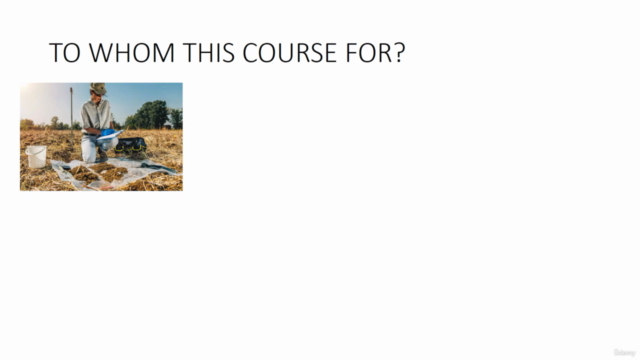
📚 Who Should Take This Course? This course is ideal for:
- Students in environmental science, geography, or GIS programs
- Professionals in environmental consulting, agriculture, urban planning, and natural resource management
- Anyone interested in applying GIS technology to solve real-world environmental problems
Course Overview:
Water Erosion: A Global Concern 🌊 Understand the gravity of water erosion's impact on our environment and human activities. We'll explore how this natural phenomenon can lead to:
- Degradation of agricultural lands
- Loss of soil fertility
- Threatening biodiversity
- Infrastructure damage
- Increased risk of floods and landslides
The Power of AHP in GIS Analysis 🧠⚖️ Learn about the Analytical Hierarchy Process (AHP), a robust multi-criteria decision analysis (MCDA) tool that integrates both psychological and mathematical methods to make informed decisions. AHP's versatility is demonstrated in various applications, from academic choices to complex decision-making processes like erosion modeling.
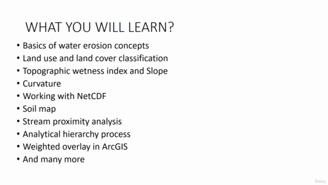
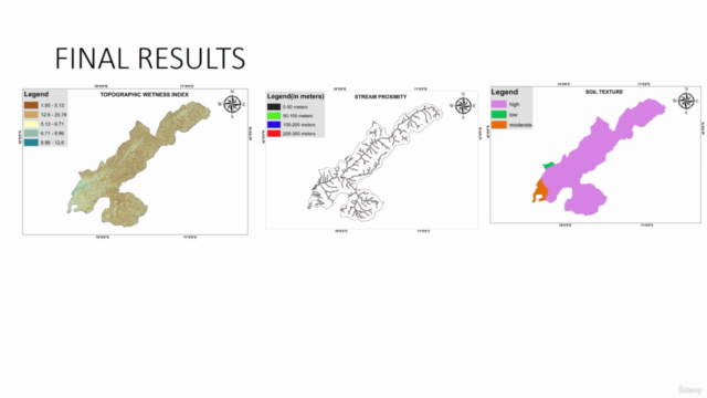
Dive Deep into GIS Layers 🧺 This course will guide you through the preparation of seven critical thematic layers that influence water erosion:
- Land Use/Land Cover (LULC)
- Precipitation Patterns
- Slope Gradients
- Curvature Analysis
- Topographic Wetness Index (TWI)
- Soil Texture Characteristics
- Proximity to Streams and Water Bodies
From Theory to Practice: A Hands-On Learning Experience 🛠️ With ArcGIS as your toolbox, you'll apply the knowledge gained in this course to create a detailed map of water erosion susceptibility for any study area. You'll walk away with a clear understanding of the factors contributing to soil erosion and how to effectively map them.
Practical Skills Acquired:
- Preparing and handling thematic layers in GIS
- Implementing AHP to weigh factors affecting water erosion
- Developing a comprehensive erosion risk map using MCDA
- Analyzing results for research, publications, or practical decision-making
Why Take This Course? This course is designed to cater to both beginners and intermediate users of GIS and soil science. With a focus on practical application (80%) and hands-on lectures, you'll be well-prepared to tackle the complexities of water erosion in various contexts, including academic research or professional projects.
Your Outcome: Upon completion, you will have the skills and knowledge to:
- Conduct spatial mapping of water erosion susceptibility
- Analyze and understand the factors contributing to soil erosion
- Apply your findings to a range of applications, from thesis work to real-world problem-solving
Ready to transform your understanding of water erosion and GIS analysis? Enroll in "Spatial Mapping of Water Erosion with MCDA Tools in ArcGIS" today and take the first step towards becoming a GIS expert! 🌟
Course Gallery


Loading charts...