QGIS for Land Degradation Assessment & SDG monitoring in GIS

Why take this course?
🎉 Conduct Remote Sensing & GIS for Land Degradation Assessment & Sustainable Development Goals (SDGs) Indicators 🎉
Mastering Geospatial Analysis for Sustainable Development
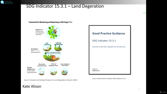
This comprehensive course is meticulously crafted for individuals who wish to harness the power of GIS, Remote Sensing, and cloud computing to perform land degradation assessment and monitor Sustainable Development Goals (SDGs) Indicator 15.3, specifically focusing on the 'Proportion of Degraded Land.' Join us on this transformative journey that blends theoretical insights with hands-on practicality, all within the realm of QGIS.
Course Highlights:
-
Harness the Power of Big Data in the Cloud: Learn to work with large datasets and leverage cloud computing resources through QGIS. No prior experience? No problem! This course is designed for those with a basic understanding of GIS, geospatial data, and Remote Sensing.
-
SDGs Indicator Computation with TrendsEarth: Dive into the world of SDGs indicators computation using the TrendsEarth plugin in QGIS. This module is crucial for contributing to global sustainability goals.
-
Intuitive Cloud Computing with EO-browser: Navigate user-friendly cloud computing with EO-browser, ensuring you can efficiently access and process geospatial data for your projects.
What You'll Gain:
This course equips you with both theoretical and practical knowledge in applied geospatial analysis, with a strong emphasis on Remote Sensing and Geographic Information Systems (GIS). You'll master:
- The foundations of Remote Sensing using open-source tools (QGIS)
- Working proficiency with open-source GIS software and tools (QGIS, Google Earth Engine, TrendsEarth Plugin)
- The art of conducting GIS and Remote Sensing analysis for monitoring SDGs Indicators and environmental applications, including land degradation monitoring
Course Inclusions:
We provide you with access to all the data and scripts used throughout the course, ensuring you have the resources needed to further hone your geospatial skills. Plus, you'll gain access to future resources to stay ahead in the field.
Don't miss this opportunity to become a proficient geospatial analyst, making a meaningful contribution to sustainable development. Enroll today and unlock the door to a world of possibilities in geospatial analysis! 🚀
Key Takeaways:
- Learn advanced QGIS techniques for land degradation assessment and SDGs monitoring
- Gain hands-on experience with Big Data analytics in the context of environmental sustainability
- Understand how to use cutting-edge tools like TrendsEarth and EO-browser for geospatial analysis
- Access comprehensive course materials, including datasets and scripts
- Stay updated with the latest resources and advancements in geospatial technology
- Join a community of professionals committed to sustainable development goals
Why This Course?
- Expert Instruction: Led by Kate Alison, an expert in GIS and Remote Sensing with extensive experience in land degradation assessment.
- Practical Skills: Develop real-world skills that are highly sought after in environmental science, conservation, urban planning, and more.
- Open Source Tools: Focus on open-source tools like QGIS to provide you with a robust skill set that is accessible and empowering.
- Global Impact: Contribute to global sustainability efforts by monitoring land degradation and SDGs indicators.
- Career Advancement: Enhance your resume with skills in GIS, Remote Sensing, and data analysis, opening up new career opportunities.
Enroll Now and Start Your Journey Towards Becoming a Geospatial Expert! 🌟
Course Gallery


Loading charts...