Geospatial Data Analyses & Remote Sensing: 5 Courses in 1

Why take this course?
🚀 Geospatial Data Analyses & Remote Sensing: 5 Courses in 1 🌏✨
Course Headline:
Master Geospatial Skills with Remote Sensing, QGIS, GIS & Machine Learning
Are you ready to dive deep into the world of Geospatial Analyses and Remote Sensing? 🌍 Whether you're a beginner or looking to refine your pro skills, our Practical Geospatial Masterclass is your all-in-one solution. Say goodbye to the confusion and complexity surrounding terms like "Remote Sensing object-based image analysis," "machine learning," "QGIS," or "Google Earth Engine." 🤯
Course Description:
This comprehensive learning experience combines the content of four separate courses into a single, powerful curriculum. With over nine hours of engaging video content, hands-on exercises, and a wealth of downloadable materials, this course is designed to take you from zero to hero in practical geospatial analysis. 🎥🖥️
You'll navigate through the intricacies of land use and land cover mapping, master change detection, delve into machine learning for GIS, and become adept at data manipulation and map creation—all leveraging free software tools like QGIS and Google Earth Engine. 🗺️🛰️
Course Highlights:
- Comprehensive Knowledge: Acquire extensive theoretical and practical geospatial knowledge.
- Machine Learning Applications: Learn how to apply Machine Learning in GIS and Remote Sensing.
- Land Use & Land Cover Mapping: Get hands-on with mapping real-world scenarios.
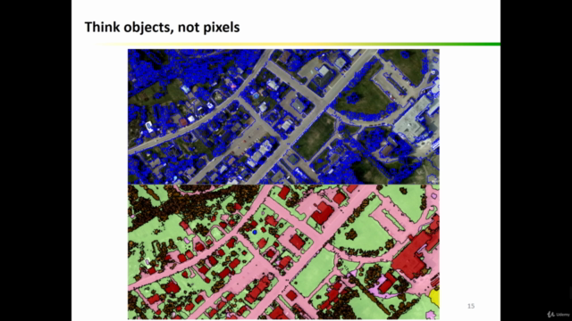
- Object-Based Image Analysis: Understand and implement this powerful technique for image analysis.
- Data Processing & Map Creation: Gain expertise in processing data and creating professional maps.
- Practical Exercises: Engage with QGIS and Google Earth Engine through real-world exercises. 🖱️📊
Course Focus:
This masterclass is tailored to empower you with both theoretical and practical geospatial analysis skills, focusing on:
- Remote Sensing & GIS Fundamentals: Get a strong foundation in the essentials of Remote Sensing and GIS.
- Machine Learning in Geospatial Tasks: Explore how Machine Learning algorithms can enhance your analyses.
- Open Source Tools: Learn to harness the power of open source and free software tools for geospatial analysis. 💻🌍
What You'll Learn:
- Machine Learning in QGIS: Utilize Machine Learning algorithms within QGIS.
- Satellite Imagery Processing: Learn to download and process satellite imagery for your analyses.
- Supervised & Unsupervised Learning: Understand the nuances of both supervised and unsupervised learning in a geospatial context.
- Accuracy Assessment & Change Detection: Gain insights into assessing accuracy and detecting changes over time.
- Object-Based Image Analysis (OBIA): Master OBIA techniques to analyze satellite imagery effectively.
- Google Earth Engine: Discover how to use Google Earth Engine for cloud computing and Big Data analysis in geospatial projects. 🌫️🔬
Who Should Enroll:
This course is perfect for a diverse range of professionals, including:
- Geographers
- Programmers
- Social Scientists
- Geologists
- GIS & Remote Sensing Experts
- And anyone eager to enhance their geospatial skill set! 🤝
Whether you're starting out or a seasoned expert looking to expand your knowledge in Machine Learning for GIS and Remote Sensing, this course is designed for all levels. It provides the confidence and skills necessary to tackle any geospatial challenge that comes your way. 🌟
WHAT'S INCLUDED:
- Precise Instructions: Clear and actionable guidance throughout the course.
- Downloadable Materials: Access to practical materials, scripts, and datasets for hands-on geospatial analysis.
- QGIS & Google Earth Engine: Learn to use these powerful open source tools to their full potential. 🛠️🌎
Enroll now to unlock the full potential of practical geospatial analysis and embark on a journey to master Remote Sensing, QGIS, GIS, and Machine Learning! 🎓🚀
Course Gallery


Loading charts...