EN.1.UAV Drones: Introduction to 3D mapping
Why take this course?
🛫 Course Headline: Master the Art of Efficiency with UAV Drones & 3D Mapping! 🚀
Course Title: EN.1.UAV Drones: Introduction to 3D Mapping
Course Description: Are you ready to revolutionize the way you approach engineering projects? Dive into the world of UAV Drones and Photogrammetry with our comprehensive online course, designed to save you both time and resources. EN.1.UAV Drones: Introduction to 3D Mapping is your ultimate guide to leveraging cutting-edge drone technology for efficient and cost-effective 3D mapping.
🎓 What You'll Learn:
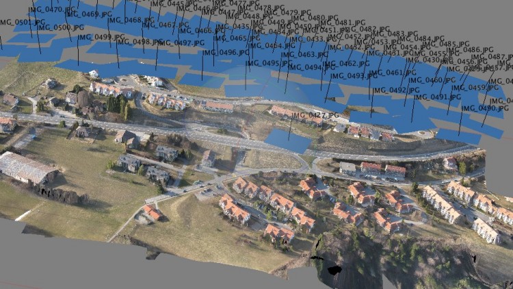
- The Basics of Photogrammetry: Understand the science behind creating 3D maps using photographs, the principles of triangulation, and how it can be applied to a variety of projects.
- Industry Applications: Discover where photogrammetry shines—from construction and mining to land surveying and archaeology. Learn which sectors benefit most from this technology.
- Business Models: Explore different business models that utilize UAV drones for mapping, and how to monetize your new skills.
- Equipment Essentials: Get to know the ideal drones, cameras, and software necessary for quality 3D maps. We'll help you navigate through the options to choose the best setup for your needs.
- Safety & Operations: Learn safety protocols and operational tips to ensure compliance with regulations while maximizing efficiency and precision.
🖥️ Course Features:
- Animated Presentations: Engage with interactive content that brings complex concepts to life.
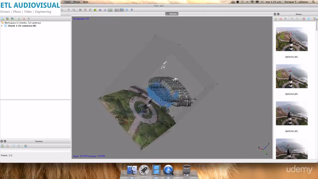
- Real-World Examples: Study actual photos and videos showcasing UAV drones in action, demonstrating the power of photogrammetry firsthand.
- Practical Exercises: Take the knowledge you gain and apply it through hands-on practice with provided samples over a weekend.
- Professional Insights: Learn from an industry expert, Enrique Eduardo Toro Lira Quiñones, who brings years of experience to the course.
⏱️ Course Duration: Complete the theoretical part in a single day and dedicate a following weekend for practical exercises.
💰 Cost vs. Value:
- Save Big: Replace expensive surveying equipment like topographers, total stations, and laser scanners with just one UAV platform and photogrammetry software suite.
- Invest Wisely: A small UAV can start at $1200, and photogrammetry software from as little as $0—with precision that rivals gear costing up to $150,000!
Why Take This Course? If you're looking to modernize your surveying methods, enhance safety, and reduce costs without compromising on quality, this is the course for you. EN.1.UAV Drones: Introduction to 3D Mapping is your key to unlocking a more efficient and profitable future in engineering projects. Don't let outdated methods hold you back—embrace the power of UAV drones and photogrammetry today!
Enroll now and take the first step towards transforming your professional toolkit with cutting-edge technology that's both accessible and affordable. 🌟
Who is this course for?
- Surveyors & Engineers
- Construction Managers
- Architects
- Landscape Architects
- GIS Specialists
- Environmental Scientists
- Students of Surveying, Engineering, or Geospatial Science
- Entrepreneurs looking to enter the drone survey market
Join us and be part of the drone revolution in 3D mapping. Let's innovate together! 🛫✨
Course Gallery
Loading charts...