QGIS for Beginners #2:Georeference, Digitize in QGIS3 +eBook
Why take this course?
🎉 Master QGIS from Scratch: Your Comprehensive Guide to Georeferencing and Digitizing 🌱🔍
Welcome to QGIS for Beginners #2!
Are you ready to unlock the secrets of geospatial data management with just the equipment you have in your office? Join me, Ian Allan, a seasoned geography and GIS researcher, teacher, modeler, and consultant since 1993, on an engaging journey through the world of QGIS. With my expert guidance, you'll learn to digitize paper maps and perform georeferencing in QGIS like a pro!
🚀 Here's What You Can Expect from This Course:
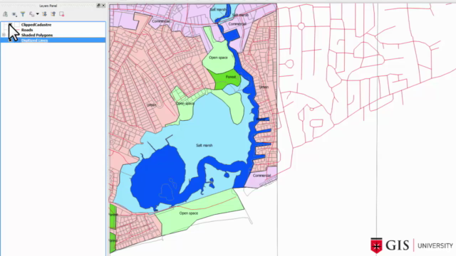
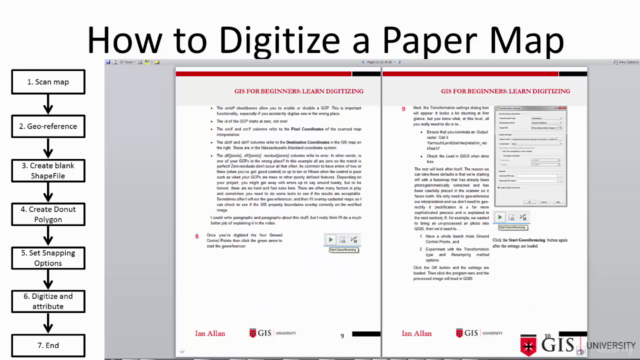
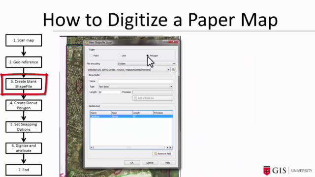
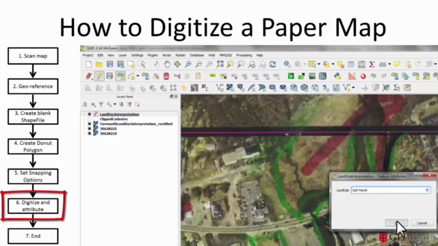
- Step-by-Step Process: I'll walk you through a six-step process to digitize your own maps, from scanning to on-screen digitizing.
- Real-World Applications: Learn the same methods I've applied in aboriginal heritage, ecological, wastewater, infrastructure, housing, and demographic studies.
- Hands-On Learning: With an 87-page eBook and a teaching dataset, you'll get a mix of video tutorials and practical exercises to solidify your learning.
📚 Course Highlights:
- Free eBook (87 pages) full of screen captures and explanatory text to complement the videos.
- In-Depth Video Tutorial (1.5 hours) where I demonstrate the digitization process in a clear, concise, and engaging manner.
- Datasets for Practice: A zip file containing datasets used throughout the course so you can follow along and apply what you learn.
- Risk-Free Learning: Try the course risk-free with a 30-day money-back guarantee if you're not satisfied for any reason.
- Unlimited Lifetime Access: Learn at your own pace, with access to all future updates of the course materials.
🤝 FAQs:
- Do I need prior GIS knowledge? No! But basic QGIS skills like opening a map and navigation are recommended. Check out my QGIS tutorial for Beginners #1 if you're starting from scratch.
- Is ARC software needed? Absolutely not! This course focuses on the free and powerful QGIS software.
- What support is available if I have questions or need help? You can ask questions directly within the course Q&A area, and I encourage it as it helps improve the learning experience for everyone!
📈 Why Choose This Course?
- Practical Focus: I use everyday GIS problems from my consultancy to make the lessons relatable and applicable to real-world scenarios.
- Flexible Learning: You can pause, rewind, fast-forward, speed up or slow down the videos according to your pace of learning.
- Community Support: Engage with a community of learners just like you, all looking to expand their GIS skills with QGIS.
💡 Transform Your Data Handling Skills Today!
Don't let complex geospatial data intimidate you any longer. With this course, you'll have the tools and knowledge to handle and analyze spatial data like never before. Dive into the world of QGIS and start your journey towards becoming a GIS expert from the comfort of your workspace.
Enroll now and take the first step towards mastering QGIS with confidence and ease. Let's get started! 🚀📍
Course Gallery
Loading charts...