GIS Certification Course : Geographic Information Systems

Why take this course?
🌱 Unlock the World of Geospatial Intelligence with NIBT's GIS Certification Course!
🎉 Course Headline: First Step to Master GIS-Geographic Information System!
🚀 Course Description: Are you ready to embark on a journey into the fascinating realm of Geographic Information Systems (GIS) and Photogrammetry? Our comprehensive online course from the esteemed National Institute of Building Technology (NIBT) is your gateway to understanding the power of spatial data analysis. With GIS, you can turn complex, real-world problems into manageable information layers. 🌍✨
📍 Why Choose This Course?
- Integrated Learning: Get a complete overview of GIS and Photogrammetry, with a focus on software like MicroStation, LPS (Leica Photogrammetry Suit), PRO600, and TerraModel.
- Practical Application: Learn through hands-on experience with high-resolution aerial photographs to create detailed 3D models. 📸🌟
- Advanced Concepts: Dive deep into Stereo Compilation processes, which are fundamental in Photogrammetry. 🔍
🛠️ What Will You Learn?
- Harness MicroStation as a robust Mapping software for Photogrammetry 🗺️
- Master PRO600-PROCart, a specialized Photogrammetry software 🖥️
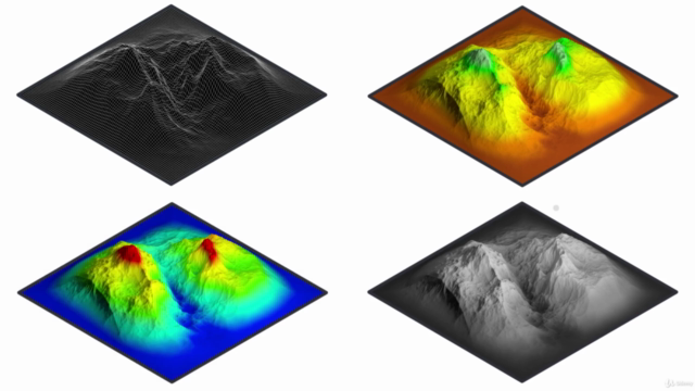
- Compile detailed planimetric features and Digital Terrain Models (DTM) using LPS in a 3D environment 🌫️
- Construct accurate Contours, Shaded Surfaces, and Triangulated Irregular Networks (TIN) using TerraModel in Photogrammetry projects 🖨️
- Understand the entire workflow of Photogrammetry projects from start to finish 🎞️
🎓 Key Takeaways:
- A solid grasp of GIS and Photogrammetry principles.
- Proficiency with industry-leading software tools for spatial data analysis and visualization.
- The ability to create accurate, scalable models from aerial photographs.
- A comprehensive understanding of the entire photogrammetry workflow, from data collection to final product delivery.
🤝 Who Should Take This Course?
- Surveyors and Mappers looking to expand their skillset with GIS and Photogrammetry.
- Civil Engineers and Architects aiming to integrate spatial technology into their projects.
- Environmental Scientists interested in leveraging geospatial data for conservation efforts.
- Data Analysts who wish to add a geographical dimension to their data analysis.
📅 Enroll Now and Transform Your Career with Geospatial Expertise! Embark on your GIS journey today and become a key player in the rapidly evolving field of spatial technology. With NIBT's GIS Certification Course, you're not just learning—you're unlocking new opportunities! 🌐🚀
Course Gallery


Loading charts...