Learn Geographic Information Systems with geodjango
Learn how to create location based applicatons like swarm, foursquare or tinder.
3.46 (38 reviews)

227
students
3 hours
content
Feb 2016
last update
$19.99
regular price
Why take this course?
🌐 Dive into the World of Geographic Information Systems (GIS) with GeoDjango!
🚀 Course Title: Learn Geographic Information Systems with geodjangocourse headline: Master location-based applications like Swarm, Foursquare, or Tinder.
🎉 What You'll Learn:
Understanding PointField and PolygonField
- 🌍 What is a PointField? It's the data type used to store coordinates (latitude and longitude) of users, like when you check in using an app.
- 📍 What is a PolygonField? This data type plots specific areas, such as cities or land parcels, on a map.
🔍 Real-world Applications:
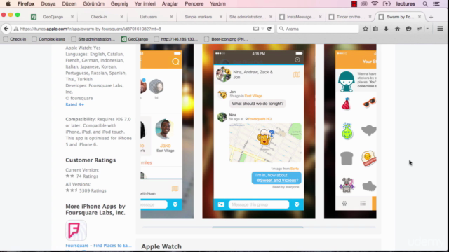
- Swarm suggests places of interest based on your current location, saving your latitude and longitude in a PointField.
- Example: Checking in at Burger King with nearby suggestions like Starbucks.
- Tinder uses PolygonField to find users within specific distances, ensuring you don't see profiles from too far away, like Germany if you're in Turkey.
🛠️ Practical Skills:
- Learn to create filters that list users or locations from the closest to the most distant within a chosen kilometer range.
- Discover how to calculate distance between users using km's or miles.
🎉 Develop Your Own Location-based Apps:
- Create an app to "Find My Friends" on a map.
- Develop an app for vehicle tracking for rental car businesses.
- Design real estate apps that display property locations on Google Maps with additional details.
📚 Google Maps Mastery:
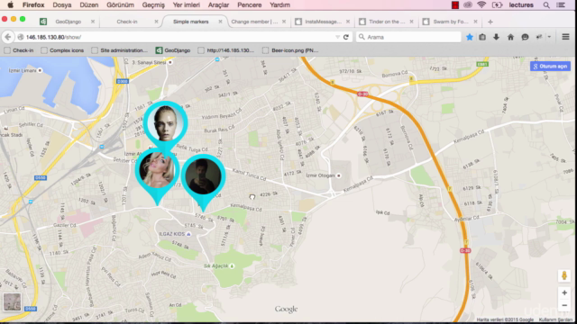
- Learn how to show saved people over a map.
- Understand map markers, including complex ones with links to photos and additional information.
🌍 Latitude & Longitude: Finding Coordinates Everywhere!
- Utilize HTML5 Geolocation for web applications.
- Receive latitude and longitude information in mobile apps (Objective-C for iOS and Java for Android).
🔑 GeoIP Explained:
- Learn to work with IP addresses to retrieve country, county, city, district, or address information.
- Yes, you'll learn how to use the GEOIP library!
📚 Additional Resources:
- More info on GeoDjango and how it integrates with Tumblr addresses.
🎓 Why Take This Course?
- If you're interested in developing geographic information systems or location-based services, this course is a comprehensive guide to understanding and implementing GIS in real-world scenarios.
- With hands-on examples from popular apps like Swarm and Tinder, you'll gain insights into how these technologies are applied in the industry.
- The knowledge of PointField, PolygonField, Google Maps, HTML5 Geolocation, and GeoIP will empower you to create innovative solutions for a variety of applications.
🤝 Who Should Take This Course?
- Aspiring developers who want to build location-based features into their web or mobile applications.
- Data analysts looking to enhance their spatial data analysis skills.
- Anyone curious about the technology that powers geographic information systems and how they can leverage this knowledge for various use cases.
📅 Start Your Journey Today: Embrace the opportunity to become a GIS expert with GeoDjango and unlock the potential of location-based applications! 🌍➡️🚀
Course Gallery


Loading charts...
Related Topics
305714
udemy ID
22/09/2014
course created date
01/12/2020
course indexed date
Bot
course submited by