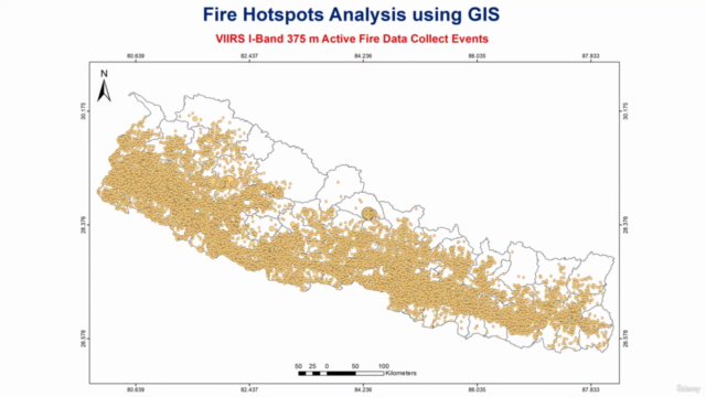
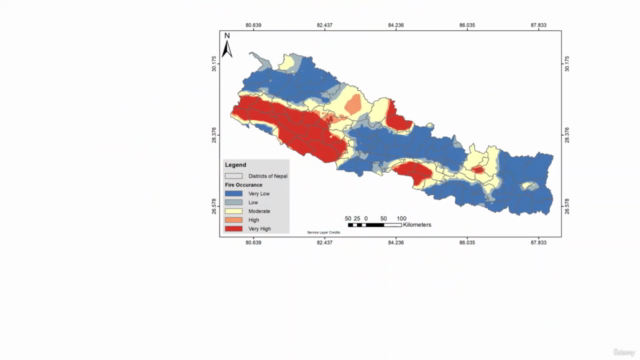
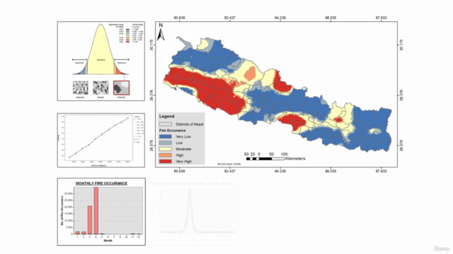
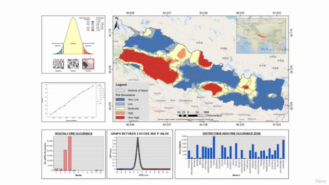
Fire Hotspots Analysis using GIS

Why take this course?
🌏 Fire Hotspots Analysis using GIS: Spatial Auto Correlation and Hotspots Analysis 🌡️
Course Headline:
Unlock the Power of Spatial Data with GIS to Analyze and Visualize Fire Hotspots!
Course Description:
Overview: Dive into the world of Geographic Information Systems (GIS) and remote sensing with our comprehensive online course. Leverage NASA's cutting-edge VIIRS-375m Active Fire Data to pinpoint fire hotspots across specific study areas. With a focus on spatial autocorrelation and hotspot analysis, you'll learn to harness the capabilities of ArcGIS Spatial Statistics Tools to identify, analyze, and visualize critical data for resource management and environmental monitoring.
Key Course Objectives:
-
Understanding VIIRS Data: Learn about the Visible Infrared Imaging Radiometer Suite (VIIRS) and its significance in detecting active fires with finer spatial resolution of 375m.
-
Spatial Hotspot Analysis: Discover how to identify clusters of fire hotspots using ArcGIS, and understand the confidence levels associated with these detections (90%, 95%, and 99% confident).
-
Spatial Autocorrelation with Moran's I: Explore the concept of spatial autocorrelation and how it indicates whether similar or dissimilar values are clustered in your data. Learn to interpret Moran's I scores to determine positive, negative, or no spatial auto-correlation.
-
Data Visualization & Map Design: Prepare compelling charts, graphs, and patterns that provide insights into fire data distribution over space and time. Master the art of designing informative and comprehensive fire hotspots maps.
-
Final Project: Apply your new skills to compile all analyzed data into ArcGIS, culminating in a detailed and presentable map layout design that effectively communicates critical information about fire hotspots.
Course Features:
-
Real-World Data: Work with actual VIIRS-375m Active Fire Data to gain practical experience.
-
Advanced GIS Tools: Utilize ArcGIS Spatial Statistics Tools to perform sophisticated spatial analyses.
-
Expert Instruction: Learn from Bijaya Maharjan, a seasoned course instructor with a wealth of knowledge in GIS and remote sensing applications.
-
Interactive Learning: Engage with interactive exercises that allow you to apply concepts in real-time.
-
Comprehensive Resources: Access detailed lesson notes, supplementary reading materials, and video tutorials to enhance your learning experience.
Why Take This Course? This course is ideal for environmental scientists, resource managers, urban planners, emergency responders, and anyone interested in the application of GIS in analyzing spatial patterns, particularly related to fire occurrences. By completing this course, you will be equipped with the skills to make informed decisions based on geospatial data analysis, which is crucial for effective disaster management and environmental conservation efforts.
Enroll now to embark on your journey to becoming a GIS expert in fire hotspots analysis! 🔥🌍📊
Course Gallery


Loading charts...