Deep Learning Application for Earth Observation

Why take this course?
🌏 Deep Learning Application for Earth Observation 🚀
Course Title: Satellite Image Processing using Deep Learning Neural Networks
Headline: Unveiling the Secrets of our Planet: Harnessing the Power of AI in Earth Observation 🛰️✨
Course Description:
Embark on a journey into the fascinating world of Machine Learning, where we delve deep into the realm of Deep Learning – a transformative technology that revolutionizes the way we process and analyze satellite images. In this comprehensive course, "Deep Learning Application for Earth Observation," you will unlock the mysteries of earth observation through the lens of AI-driven neural networks.
What You'll Learn:
🚀 Introduction to Deep Learning: Get acquainted with the fundamentals of deep learning algorithms and understand how these mathematical functions can learn from data to extract meaningful patterns and insights.
🧠 Concepts of Machine Learning & Training Models: Dive into the core concepts of machine learning, including the importance of training models to recognize patterns in satellite imagery for various applications.
📊 Computer Vision Techniques: Explore the intersection of deep learning with computer vision techniques, which are crucial for automatic detection and interpretation of complex visual data from space.
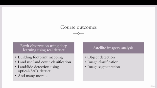
🌍 Earth Observation Applications: Discover how AI algorithms can be applied to earth observation (EO) applications, from natural resource management to disaster response and climate change monitoring.
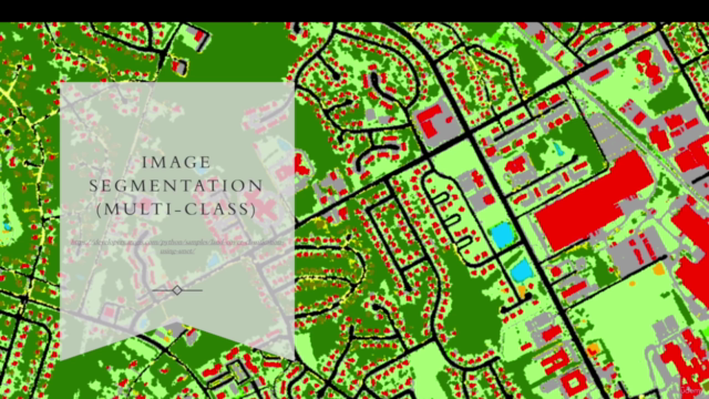
🤖 Convolutional Neural Networks (CNNs): Learn about the power of CNNs in image recognition, object detection, and semantic segmentation, and how these can be leveraged for analyzing satellite data.
Technology Tools:
This course is hands-on and practical, utilizing cutting-edge tools to bring deep learning to life in the context of EO applications. You will gain proficiency in:
✅ Tensorflow & Keras: Master Tensorflow and use Keras to train your own deep learning models for image processing tasks.
✅ Google Colab: Gain access to powerful computing resources on the cloud using Google Colab notebooks, allowing you to run your DL models without needing local hardware.
✅ GeoTile Package: Learn how to create and manage datasets for deep learning from satellite imagery with the GeoTile package.
✅ ArcGIS Pro & QGIS: Use these tools to visualize and analyze the outputs of your deep learning models, integrating geographic information system (GIS) capabilities into your EO analysis.
Why Take This Course?
-
📈 Industry-Relevant Skills: Stay ahead in the competitive field of earth observation by mastering the latest AI techniques.
-
🤝 Real-World Applications: Apply your knowledge to tangible projects that can make a real difference in environmental monitoring, urban planning, and more.
-
🎓 Interactive Learning: Engage with hands-on assignments and real satellite data, learning by doing and solidifying your understanding of deep learning concepts.
-
🔍 Expert Instructor: Learn from Tek Bahadur Kshetri, an expert instructor with a wealth of experience in deep learning applications for earth observation.
Enroll now and transform the way you approach satellite image processing! 🚀🌍💫
Course Gallery


Loading charts...