Complete Remote Sensing and GIS - ArcGIS - Erdas

Why take this course?
🌟 Master Real-life GIS Projects with Complete Remote Sensing and GIS - ArcGIS & ERDAS Course 🌟
Course Overview:
This comprehensive course is designed to equip you with the practical skills necessary to tackle real-world geospatial challenges using ArcGIS, ERDAS, and other remote sensing tools. Whether you're a Master's student, a PhD candidate, or a Civil Engineer, this course will cover the essential hands-on tasks that form the backbone of any GIS project.
What You'll Learn:
- GIS Basics: From DEM to Mosaic, NDVI to 3D visualization, we'll delve into the fundamental tasks required for a successful GIS project lifecycle.
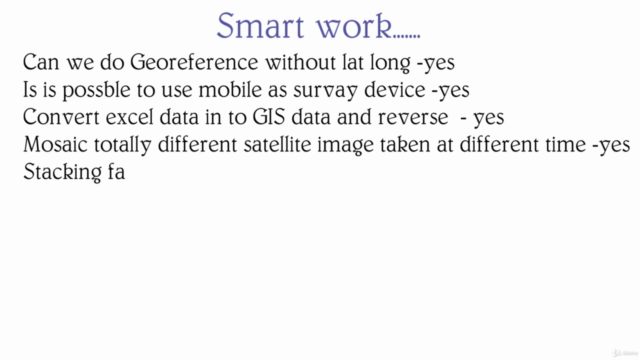
- Data Conversion & Management: Learn to convert Excel data to GIS format, handle NetCDF data, and manage raster and vector data of various types.
- Error Resolution: Understand how to resolve errors in software outputs and deal with issues related to satellite data.
- Advanced Data Analysis: Discover how to process satellite imagery, analyze rainfall data, and generate high-impact GIS layouts for research and presentations.
- GPS Surveying & Android Phone Usage: Calibrate your Android phone's GPS for surveying with up to 3-meter accuracy and learn how to use this data effectively in GIS.
- Practical Syllabus & More: This course covers not just the theoretical aspects but also the practical syllabus of GIS, ensuring you are well-prepared for real-life scenarios.
- GIS Projection & Layout: Learn to change projections and create advanced labels using scripts to ensure your data is accurately represented.
- Error Resolution: Master error resolving techniques in software outputs and learn how to compare tasks across different software versions.
- Street-level Data Conversion: Find out how to obtain street-level data from online sources and convert it to GIS format.
- Excel to GIS: Convert Excel data into GIS formats, create grids, and much more.
Course Structure:
90% of the course is hands-on, with only 10% focused on theoretical foundations. This ensures that you understand not just how but also why certain tools are used in specific ways.
Software Versions:
This course is designed to be applicable across different versions of ArcGIS (10.1 and above) and ERDAS (2015 and above), ensuring you can apply these skills regardless of the software version you use.
Real-life GIS Problems Solved:
This course addresses numerous real-life problems encountered during GIS projects, such as:
- Working with data that is not from a topographic map
- Converting multiple Excel sheets to maps
- Handling study areas across different satellite images
- Addressing the lack of station data for weather analysis
- Utilizing NDVI for counting vegetation quickly
- Overcoming challenges like poor mouse control and autocorrection
- Advanced editing of shapefiles
- Ensuring your project presentation makes a high-impact, journal-worthy impression.
Who Should Take This Course?
This course is ideal for:
- GIS Professionals looking to enhance their practical skill set
- Master's and PhD students needing to understand the intricacies of remote sensing and GIS
- Environmental Scientists requiring precise data analysis tools
- Surveyors, Engineers, and Urban Planners seeking to incorporate real-world applications of geospatial technology in their work.
Join Us & Master Real-life GIS Projects:
Embark on a journey to become proficient in handling complex spatial data and tackle challenging GIS projects with confidence. Enroll in this course today and transform the way you approach geospatial analysis and present your findings with professional flair! 📐✈️🔍
Course Gallery


Loading charts...