Core GIS analysis in QGIS: learn conduct the GIS projects

Why take this course?
🌏 Core GIS Analysis in QGIS: Learn & Conduct GIS Projects
Unveiling the World of GIS and Remote Sensing 🌍✈️
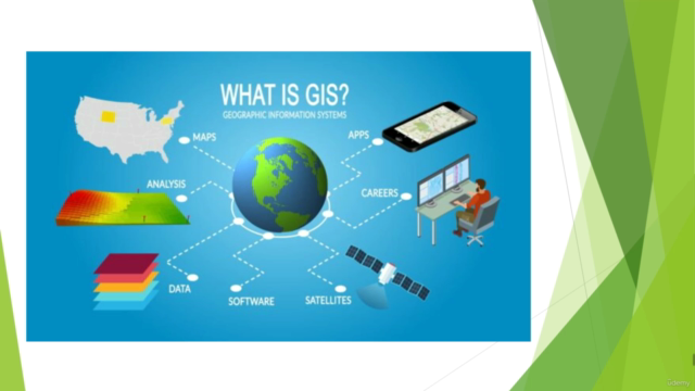
Embark on a journey to explore the dynamic field of Geographic Information Systems (GIS) and delve into the intricacies of Remote Sensing with our project-centric approach.
Fast-Track Geospatial Proficiency 🎯🚀
This practical geospatial analysis course is designed to swiftly elevate your GIS expertise. By the end, you'll confidently navigate and execute complex geospatial projects with QGIS software, transforming data into meaningful insights.
Stay Current with QGIS 🛠️✨
Our curriculum is tailored to the latest version of QGIS, ensuring you receive up-to-date training that's directly applicable to today's geospatial challenges. No outdated content here—only cutting-edge skills for a modern GIS professional.
Your Journey Starts Here 🚪🌱
We'll guide you from the basics of installing QGIS to mastering its interface and powerful plugins, setting a solid foundation for your GIS skillset. Get ready to unlock the potential of open-source software in geospatial analysis.
Real-Life GIS Projects 📚🌎
Through real-world examples and hands-on exercises, you'll learn how to approach, analyze, and solve geospatial projects using QGIS. These skills are directly transferable to academic research or professional GIS applications.
Visualize Your Success 🖼️🎉
Discover the art of presenting your GIS project results effectively. Learn how to create compelling, informative, and visually appealing maps that bring your findings to life.
Versatile Applications 🔧🌾
Our course is a versatile tool in your professional toolkit. We cover a myriad of industries that leverage GIS and Remote Sensing, providing you with a broad spectrum of applications to choose from. Prepare to apply real-world data to solve complex problems across various sectors.
Enroll Today, Excel Tomorrow ✅📈
Take the first step towards your future as a GIS professional by enrolling in this course today. With hands-on training and real-world applications, you're on track to excel in tomorrow's geospatial landscape.
Join us and let QGIS transform your data into stories that can be seen, understood, and acted upon. 🌐📊🤝
Enroll now and start your transformation into a GIS professional! Your adventure in geospatial analysis is just a click away. 🚀💫
Course Gallery


Loading charts...