Machine Learning in GIS : Land Use Land Cover Image Analysis

Why take this course?
🌏 Dive into the World of Geospatial Analysis with Machine Learning in GIS 🌍
Course Title: Machine Learning in GIS: Land Use Land Cover Image Analysis
Headline: 🚀 Become an Expert in Advanced Remote Sensing and GIS Pixel- and Object-based Image Analysis in Google Earth Engine & QGIS!
Course Description:
Advance your geospatial analysis skills to the next level with our comprehensive course on Land Use/Land Cover (LULC) mapping using Machine Learning within the context of Geographic Information Systems (GIS). This course is tailored for QGIS users who aspire to perform advanced tasks with precision and confidence. 📊
By integrating object-based image analysis and state-of-the-art Machine Learning algorithms, you'll unlock the potential of remote sensing data to map land cover types accurately. Learn through practical exercises that combine QGIS and Google Earth Engine, making you well-equipped to handle a variety of geospatial challenges. 🛰️
Course Highlights:
- Advanced Geospatial Analysis with QGIS: Transition from basic to advanced tasks effortlessly.
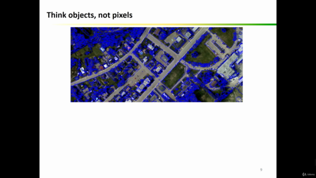
- Object-based Image Analysis: Master the intricacies of this powerful technique.
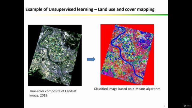
- Machine Learning Algorithms for LULC Mapping: Explore both supervised and unsupervised learning approaches.
- Hands-on Exercises: Engage with practical activities using QGIS and Google Earth Engine.
- Installation and Configuration of Open-Source GIS Software: Learn how to set up QGIS, Orfeo Toolbox, and other essential tools.
- Accuracy Assessment for Geospatial Projects: Understand the importance of evaluating your models' performance.
Course Focus:
This advanced course is meticulously designed to provide you with a deep understanding of LULC mapping, object-based image analysis, and the application of Machine Learning algorithms. With a focus on hands-on experience and practical knowledge, this course will enhance your GIS and Remote Sensing skill set, making you an asset in any project that requires detailed geospatial analysis. 🗺️
What You'll Learn:
- Installing and Configuring Open-Source GIS Software: Get up and running with QGIS and Orfeo Toolbox.
- Navigating QGIS Software Interface: Become familiar with the main components, tools, and plugins available in QGIS.
- Classifying Satellite Images: Learn to apply various Machine Learning algorithms for image classification tasks in QGIS.
- Collecting Training and Validation Data: Acquire the necessary data for your models and understand how to perform accuracy assessments.
- Object-based Image Analysis: Perform object-based crop type mapping in QGIS and gain insights into spatial patterns.
- Running Machine Learning Algorithms: Gain proficiency in using both supervised and unsupervised algorithms in Google Earth Engine.
Who Should Enroll:
This course is tailored for professionals across various fields who wish to enhance their geospatial analysis capabilities, including:
- Geographers
- Programmers
- Social Scientists
- Geologists
- Any professional needing LULC maps for their projects
Whether you're interested in creating precise land cover and land use maps or aiming to tackle complex geospatial challenges, this course offers the skills and confidence necessary to explore cutting-edge LULC techniques. 🏗️⚛️
Included in the Course:
- Access to All Course Materials: Benefit from a wealth of resources, including datasets, Java code files, and more.
- Future Resources: Stay ahead of the curve with access to new materials that will be added to enhance your learning experience.
Join our online community today and elevate your expertise in GIS and Machine Learning for Land Use and Land Cover mapping! 🌟
Course Gallery


Loading charts...