Introduction to 2 & 3D Drone Modeling With Agisoft Metashape

Why take this course?
Introduction to 2D & 3D Drone Modeling With Agisoft Metashape: Building 2D & 3D Models with Drone Images and Metashape 🚁🖥️
Course Headline: Unlock the potential of aerial imagery with this comprehensive course on 2D & 3D modeling using DJI drones and Agisoft Metashape. Dive into the world of photogrammetry and transform your raw drone footage into stunning models!
Course Description:
Welcome to a journey through the intricate process of photogrammetry with drones! This course is your gateway to mastering 2D & 3D Modeling using Agisoft Metashape, one of the leading photogrammetry software solutions in the market. Our expert-led program is designed to take you from the basics of capturing images with DJI drones to creating detailed models with Metashape.
What You'll Learn:
-
Capturing Images for Modeling: Understand the importance of image capture and learn how to use various applications to set up your drone flights for optimal modeling results.
-
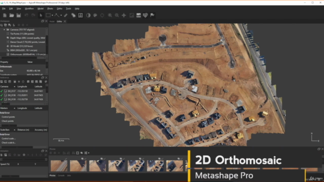
Introduction to Metashape: Familiarize yourself with both the Standard Edition and Pro Edition of Metashape, and get to know the software's interface and capabilities. Whether you're a beginner or looking to refine your skills, this course will guide you through the modeling process.
-
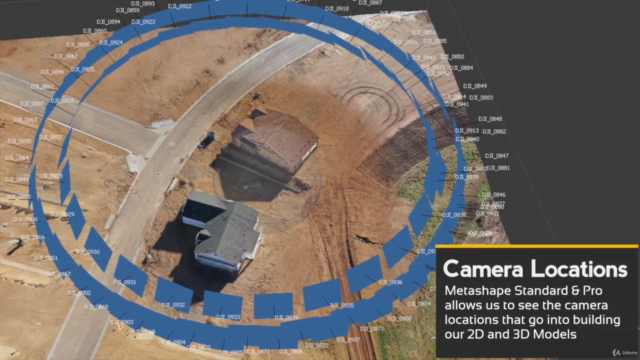
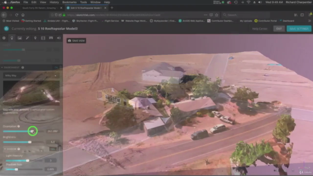
The Modeling Workflow: Gain hands-on experience with the workflow essentials for drone modeling: importing images, aligning them to create a point cloud, generating a 3D mesh, and applying textures to bring your model to life.
-
Ground Control Points and Advanced Topics: While we'll cover the basics of manual image alignment and Ground Control Points (GCPs), this course will primarily focus on the general process of photogrammetry for those just starting out in drone modeling. For a deep dive into GCPs, consider our advanced classes.
-
Pilot Responsibilities: Learn about the responsibilities of a Drone Pilot in Command (PIC) when it comes to mapping and modeling, including adherence to safety and legal regulations.
Course Highlights:
-
Step-by-Step Guidance: From capturing drone images to generating 2D & 3D models with Metashape.
-
Real-World Application: Practical examples and tips on how to capture images for optimal model results.
-
Software Proficiency: Learn the ins and outs of Metashape, suitable for both beginners and professionals.
-
Professional Development: Elevate your skills with advanced modeling techniques and gain a deeper understanding of photogrammetry.
Why Take This Course?
Whether you're a surveyor, architect, geologist, or any professional interested in leveraging drones for mapping and data acquisition, this course will equip you with the necessary skills to create accurate 2D & 3D models. By mastering the use of DJI drones and Agisoft Metashape, you'll be able to capture aerial imagery and process it into detailed photogrammetric models, enhancing your ability to analyze and visualize data in ways never before possible.
Embark on your photogrammetry journey today and transform raw drone data into actionable insights with Agisoft Metashape! 🚀📏
-
Capturing Drone Images for Modeling: A section dedicated to the art of capturing the right images from the sky. We'll explore different capture applications and discuss the best flight setups to ensure your models are as accurate as possible. ☁️📸
-
Mastering Metashape: Dive into the Standard Edition and Pro Edition of Metashape, designed to cater to all levels of users. Understand how to navigate the software, align images, generate point clouds, and create detailed 3D models with textures. 🖨️👓
-
Basic Modeling Principles: Learn the fundamental steps of photogrammetry, from image capture to final model creation. This course sets a solid foundation for understanding the entire modeling process. ✅🔗
-
Flight Safety and Legal Requirements: As a future drone pilot or PIC, it's crucial to understand your responsibilities, including safety protocols and legal regulations that govern drone flights. This course emphasizes the importance of being an informed and compliant pilot. 🛫⚖️
Enroll now and start your adventure in photogrammetry with Agisoft Metashape! 🌟🧭
Course Gallery


Loading charts...